|
 Though
not the largest in area, the Punjab is the most populous province and the
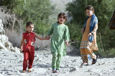
most developed. It is the nerve centre of Pakistan. Its people are
warm-hearted and hardworking. The capital, Lahore, ahs been the seat of learning and
power for centuries. Situated on the left bank of the river Ravi - one of the
five rivers of Punjab - the city has the
largest number of well preserved monuments of architectural and historical
value. Punjab consists mostly of plains north and south of the ancient Salt Range
which runs form east to west. Its economy is agro-based and it has world's
largest and the most efficient network of canals. Punjab is known for a great
variety of arts and crafts from the blue tiles of Multan to the wood work of Chiniot as well
as industrial units. It's land of manly games, of sturdy pehalwans, of robust
cattle and dairy farms, its folklore and love legends, and is known for
haunting music. Punjab can be divided into 5
major physical regions: Northern mountains, South Western mountains, Pothwar
Plateau, The Upper Indus Plain, & The Deserts. In the north there are the
outer ranges of the Hamalayas: the Murree and the Kahuta hills in the north
and the Pubbi hills of Gujrat in the south. In the south west the hills of
Sulaiman Though
not the largest in area, the Punjab is the most populous province and the
most developed. It is the nerve centre of Pakistan. Its people are
warm-hearted and hardworking. The capital, Lahore, ahs been the seat of learning and
power for centuries. Situated on the left bank of the river Ravi - one of the
five rivers of Punjab - the city has the
largest number of well preserved monuments of architectural and historical
value. Punjab consists mostly of plains north and south of the ancient Salt Range
which runs form east to west. Its economy is agro-based and it has world's
largest and the most efficient network of canals. Punjab is known for a great
variety of arts and crafts from the blue tiles of Multan to the wood work of Chiniot as well
as industrial units. It's land of manly games, of sturdy pehalwans, of robust
cattle and dairy farms, its folklore and love legends, and is known for
haunting music. Punjab can be divided into 5
major physical regions: Northern mountains, South Western mountains, Pothwar
Plateau, The Upper Indus Plain, & The Deserts. In the north there are the
outer ranges of the Hamalayas: the Murree and the Kahuta hills in the north
and the Pubbi hills of Gujrat in the south. In the south west the hills of
Sulaiman 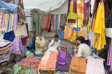 range
running from north to south in the D.G. Khan Division are no higher than
1,200 metres and are dry and barren. The area across the Indus
is also called "Derajat". The Pothwar Plateau (height, 305 to 610
metres) has an area of 12,944 sq. km. and is bounded by the Jhelum in the
east and by Indus in the west. Covering
virtually the whole of Rawalpindi Division, it extends to the norther range
running from north to south in the D.G. Khan Division are no higher than
1,200 metres and are dry and barren. The area across the Indus
is also called "Derajat". The Pothwar Plateau (height, 305 to 610
metres) has an area of 12,944 sq. km. and is bounded by the Jhelum in the
east and by Indus in the west. Covering
virtually the whole of Rawalpindi Division, it extends to the norther n
slopes of Kala Chitta
Range and Margalla Hills and to the Salt Range
in the South. It has deep ravines and slopes from north east to south west, a
direction followed by Soan
River. The Pothwar is
the earliest proven oil-bearing region and has the first and the oldest oil
refinery in Rawalpindi.
The upper Indus Plain, covering Lahore, Multan, Gujranwala and
Faisalabad Divisions and large parts of Sargodha,
D.G. Khan and Bahawalpur Divisions is a featureless terrain. With an average
gradient of 19 c.m. to one km, it slopes gently to south west. To the
south-east of Sutlej, there is a vast desert
of about 2.592 million hectares covering about two-thirds of the entire
Bahawalpur Division, divided into "Smaller" and "Greater"
Cholistan, consisting of saline alluvial land with low sand dunes, ridge and
depressions. Changa Manga National Park, Hiran Minar, Nankana Sahib, Punja
Sahib, the Attock, Rohtas and Pharwala forts, the Kallar Kahar salt lake,
Gulshan-i-Iqbal Park, Kim's Gun, and Ranjit Singh's Samadhi and some other
places of interest, are scattered all over the province. n
slopes of Kala Chitta
Range and Margalla Hills and to the Salt Range
in the South. It has deep ravines and slopes from north east to south west, a
direction followed by Soan
River. The Pothwar is
the earliest proven oil-bearing region and has the first and the oldest oil
refinery in Rawalpindi.
The upper Indus Plain, covering Lahore, Multan, Gujranwala and
Faisalabad Divisions and large parts of Sargodha,
D.G. Khan and Bahawalpur Divisions is a featureless terrain. With an average
gradient of 19 c.m. to one km, it slopes gently to south west. To the
south-east of Sutlej, there is a vast desert
of about 2.592 million hectares covering about two-thirds of the entire
Bahawalpur Division, divided into "Smaller" and "Greater"
Cholistan, consisting of saline alluvial land with low sand dunes, ridge and
depressions. Changa Manga National Park, Hiran Minar, Nankana Sahib, Punja
Sahib, the Attock, Rohtas and Pharwala forts, the Kallar Kahar salt lake,
Gulshan-i-Iqbal Park, Kim's Gun, and Ranjit Singh's Samadhi and some other
places of interest, are scattered all over the province.
|